This review of Exhibit 7 of the Fingerprints of the Gods (FOG) was originally posted to sci.archaeology and alt.archaeology on May 4, 1996 as “Part 5 – Exhibit 7 Review, Fingerprints of the Gods (Long Post)” I have edited the original post for spelling and conversion to HTML format.
Introduction – The Problem
A major thesis of Fingerprints of the Gods (FOG), by Mr. Graham Hancock, and its explanation of why artifacts and remains of his hypothetical civilization are lacking is that this civilization occupied Antarctica when it was warm and temperate. Later, FOG claims that this civilization was buried beneath a couple of miles of ice when an abrupt crustal movement moved Antarctica into the Antarctic circle.
Talking about this idea as advocated by Rand and Rose Flem-Ath in their book When the Sky Fell, FOG claims:
1. a complete slippage of the Earth’s thirty-mile-thick crust forced large parts of the western hemisphere southward towards the equator and towards Antarctic Circle,
2. work by Hapgood (1970) shows that in the southern hemisphere, the continent of Antarctica was mostly at temperate or even warm latitudes until this crustal shift moved it completely inside the Antarctic Circle,
3. this overall crustal shift had a magnitude of 30 degrees (approximately 2000 miles or 3200 kilometers), and
4. this crustal shift occurred between 14,500 BC and 12,500 BC with “massive aftershocks on a planetary scale continuing at widely-separated intervals” until 9,500 BC.
Exhibit 7, The Ross Sea Cores
Of the exhibits presented Chapter 51 of Fingerprints of the Gods (FOG), Exhibit 7 is seemingly an obscure and minor one. However, the cores in Exhibit 7 are the main and only piece of hard, physical evidence cited by Hapgood (1966, pp. 96-99) and Hapgood (1979, pp. 82-84) for his claims that the Oronteus Finaeus map of 1513 was prepared from a partially glaciated Antarctica. In fact, Hapgood (1966) uses these cores to date the likely age when the alleged source maps claimed to have been used by Finaeus were prepared. Both Hapgood (1970, pp. 107-111) and Fingerprints of the Gods (FOG) on pages 16 and 470 use these cores to both bolster their claims for a recently ice-free Antarctica and crustal displacement.
The Cores – Hough (1950)
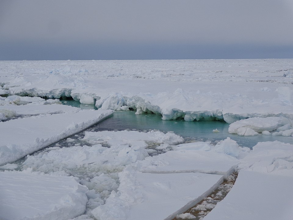
The cores were originally collected by Hough (1950) during the Byrd Expedition of 1947-1948. They were obtained by dropping and retrieving ten-foot long piston core tube with a plastic liner in 9,810 to 12,240 feet of water. The three recovered cores, N-3, N-4, and N-5, ranged in length from about 7.5 to 8.5 feet. As shown by Figure 1 of Hough (1950), they were taken, starting with N-3, 50 to 150 miles south of Scott Island. The southernmost of the cores, core N-5, was about 225 miles from the Antarctic coastline. All of the core sites lay between Scott Island and Ross Sea and north of the shelf edge (Hough 1950, Figure 1)(Appendix 1).
As shown in Figure 2 and stated by Hough (1950), in the cores:
The following sediment types were recognized: (1) Coarse glacial marine sediment; contains abundant coarse particles, including many pebbles. (2) Medium glacial marine sediment; contains fairly abundant coarse particles, including a few pebbles. (3) Fine glacial marine sediment; contains a small but appreciable amount of material coarser than 0.062 mm. in diameter, including material of granule size. (4) Fine-grained well-sorted sediment; this material was distinguished mainly by testing for absence of a gritty sensation when it was chewed. In doubtful cases the material was wet-sieved through an 0.062-mm. sieve. (5) Laminated, fine-grained, well-sorted sediment; this is similar to Type 4 except that minute lamination is observable.
These different sediment types are interlayered with each other. Of special interest is two beds of fine-grained, well-sorted sediment that occur in all three cores between 6,000 and 40,000 BP (Hough 1950, Figure 2). These beds are separated by a thin bed of coarse grain glacial sediment. In core N-5, the uppermost bed of fine-grained well-sorted sediment contains a single dropstone. In the same figure as redrafted by Hapgood (1966, 1970, 1979), the “fine grained well sorted” and “laminated fine grained well sorted” captions have been accidentally reversed from Hough (1950).
Hough (1950) is very vague about how these cores were dated. Instead of scaling his figure of the core by depth/length, he scales them by age. Neither location of the samples dated nor exact dates are given, rather Hough (1950) notes:
Age determined by W. D. Urry, using per cent of equilibrium method for uranium ionium and radium. Ages greater than 300,000 years by extrapolation.” and: “The time scale of figure 2 is believed to be fairly accurate from 0 to 300,000 years ago (Urry 1942). Beyond 300,000 the ages were obtained by extrapolation, and the possible error in ages increases with increasing age beyond this value
Interpretations by FOG
FOG (page 16) in talking about the cores presented in Exhibit 7, stated in the section titled “Ross Sea,” claims that the cores are additional evidence supporting its claims concerning how the Oronteus Finaeus map of 1513 portrays the Ross Sea. While today, massive glaciers, e.g. the Beardmore and the Scott, flow into the sea, the Oronteus Finaeus map of 1531 map shows estuaries, broad inlets, and rivers occupying the same coastal valleys. FOG claims that the implication of these differences is that the Ross Sea was free of ice and the coasts of Antarctic was unglaciated when the source maps used by Oronteus Finaeus were charted. FOG cites Hapgood (1966) as claiming that a considerable part of the coastal regions of Antarctic had to be free of ice to feed the rivers in contrast to modern times in which the coasts and interior of Antarctic are deeply buried by mile-thick ice-caps and a floating ice-shelf hundreds of feet thick occupies the Ross Sea.
On page 16, FOG states about the cores:
The sediments showed numerous clearly demarcated layers of stratification reflecting different environmental conditions in different epochs ‘coarse glacial marine’, ‘medium glacial marine’, ‘fine glacial marine’, and so on. The most surprising discovery, however, ‘-as that a number of the layers were formed of fine-grained, well-assorted sediments, such as are brought down to the sea by rivers flowing from temperate (that is, ice-free) lands (fn. 7).
Footnote 7 refers to page 97 of Hapgood (1966).
On page 16, FOG continues:
Using the ionium-dating method developed by Dr. W. D. Urry (which makes use of three different radioactive elements found in sea water (fn. 8), researchers at the Carnegie Institute in Washington DC were able to establish beyond any reasonable doubt that great rivers carrying fine grained well-assorted sediments had indeed flowed in Antarctica until about 6000 years ago, as the Oronteus Finaeus Map showed.
Footnote 8 refers to page 96 of Hapgood (1966).
However, the Carnegie Institute did not hypothesize that great rivers onced flowed into the Ross Sea before 6,000 BP, but only did the dating. Hapgood (1966, pp. 96-99: 1970, pp. 106-111: 1979, pp. 82-84) made this interpretation. Hapgood (1966, 1970, 1979) also claims that temperate climatic conditions existed from 40,000 to 6,000 BP in the Ross Sea during which riverine sediments accumulated within it.
Interpretations by Hapgood
Hapgood (1966, p. 96, 1970, p. 106: 1970, p. 106: 1979, p. 82) bases his claims of the presence of a temperate climate solely on the basis of the fine-grained layers present in the cores of Hough (1950) from 40,000 to 6,000 BP For example, Hapgood (1970, p. 106) simply states:
The cores showed alternations of types of sediment (see Fig. 24, p. 108). There was a coarse glacial sediment, as was to be expected, and finer sediment of subglacial type, but there were also layers of fine sediment typical of temperate climate. It was the sort of sediment that is carried down by rivers from ice-free continents.
This is the extent that Hapgood (1970) explains why he considers the fine grained sediments to be of river origin. Hapgood (1970) presents no other evidence, i.e. clay mineral composition, particle size distribution, microfossils, isotope data, etc., on why he considers the fine sediment to be “typical of temperate climate.”
From the association of fine grained sediments with temperate climates, Hapgood (1966) concludes that temperate climates had prevailed in Antarctica in the not distant past. Furthermore, on that basis, he claims that the sediments in cores indicated that “no fewer than three times during the Pleistocene Epoch a temperate climate had prevailed in the Ross Sea.”
Hapgood (1966, 1979) is not much more explicit about why the fine-grained sediment layers found in the Ross Sea cores of Hough (1950) demonstrate a temperate climate for Antarctic between 40,000 to 6,000 BP (Hapgood 1966, 1979) states that:
The character of sea-bottom sediments varies considerably according to the climatic conditions existing when they were formed. If sediment has been carried down by rivers and deposited out to sea it will be very fine grained, more fine-grained the farther it is from the river mouth. If it has been detached from the earth’s surface by ice and carried by glaciers and dropped out to sea by icebergs, it will be very coarse. If the river flow is only seasonal, that is if it flows only in summer, presumably from melting glaciers inland, and freezes up each winter, the sediment will be deposited somewhat like the annual rings in a tree in layers or ‘varves.’ (p. 82).
Thus, Hapgood (1966, 1979) claims that the “Fine-grained well-sorted sediment” of Hough (1950) on the basis of being simply fine-grained and nonlaminated is: 1. deposited by rivers and 2. represents evidence of a temperate climate during its deposition.
It is on the above premise, not fossils, not unique sedimentary structures, not isotopes, or other environmental indicators, that Hapgood (1966, 1979) concludes that the layers of nonlaminated, fine-grained, well-assorted sediments were brought down to the sea by rivers flowing from a temperate, ice-free Antarctica and that these layers indicate that during the last million years, Antarctica has experienced at least periods of temperate climate when the shores of the Ross Sea were free of ice. It is on these conclusions that the claims of FOG are also based, because Hapgood (1966, 1970, 1979) are the sole source of these claims for FOG.
Discussion
The assertion by Hapgood (1966, 1970, 1979) that nonlaminated well-sorted, fine-grained sediments are characteristic of riverine sediments is totally false. A quick look at The Sedimentology of Shale, Potter et al. (1979) and Facies Models: Response to Sea Level Change, (Walker and James 1992) shows that nonlaminated, fine-grained sediments, i.e. sediments composed of clay, silt, or mixture of both, lacking laminations, can accumulate within innumerable sedimentary environments including abyssal plains, continental seas, continental glaciers, intraslope basins, chenier plains, deep sea fans, deltas, alluvial plains, playa lakes, alluvial plains, glaciomarine, and pedogenic accretion gleys to name a few. Nonlaminated, fine-grained well-sorted sediments can also be carried by eolian processes and settle either on land as loess or offshore as fine-grained abyssal sediments. Unless there is other evidence, i.e. trace fossils, pedogenic features, fossils, mineralogical data, petrographic data, x-radiographs, and other data that Hough (1950) does not present, it impossible to determine the origin of nonlaminated, well-sorted, fine-grained sediments as Hapgood (1966, 1970, 1979) has done. Also, well-sorted, fine-grained nonlaminated sediments can accumulate in climates ranging from polar to tropical (Potter et al. 1979).
In fact, recent studies of the sedimentology and Quaternary geology of the Ross Sea actually document the presence of nonlaminated fine-grained sediments in the Ross Sea. A study of the modern surficial sediments of the Ross Sea by Anderson et al. (1984) shows that nonlaminated fine-grained sediments, i.e. silty clay, clayey silt, siliceous mud, and siliceous ooze are accumulating at this time within the Ross Sea despite the fact that it is currently be fed, not by rivers, but by ice streams and the ice shelf. This study clearly demonstrates that the claims of Hapgood (1966, 1979) about the climatic and sedimentological significance of fine-grained sediments are grossly incorrect. Some muds either represent fines winnowed out of glacial till or the deposits of weak contour currents called “contourites” (Anderson et al. 1984). Depending on winnowing and current action these sediments can be well-sorted. Clearly, claims by Hapgood (1966, 1970. 1979) that the fine-grained beds in the Ross Sea cores of Hough (1950) represent the prodelta / offshore deposits of temperate rivers cannot be substantiated or proven.
Since FOG relies completely on Hapgood (1966) for his data and conclusions concerning the significance of the Ross Sea Cores of Hough (1950), then the claims by FOG concerning the interpretation of the Ross Sea cores of Hough (1950) are also incorrect. Thus, contrary to claims of FOG, these Ross Sea cores fail to prove at all, and certainly not “beyond any reasonable doubt,” that:
great rivers carrying fine-grained, well-sorted sediments into the Ross Sea from Antarctica until about 6000 years ago, as the Oronteus Finaeus Map showed.
In fact, an abundance of data, including ice core data (Jouzel et al 1987, Lorius et al. 1979), cores from the Ross (Licht et al. 1996, Kellogg 1979), palynological data from tip of South America (Heusser 1989), and many more papers demonstrate that the claims by both FOG and Hapgood (1966, 1970, 1979) that the Ross Sea and its shoreline was ever ice-free and that a temperate climate in existence during the last 40,000 to 100,000 years are grossly incorrect and demonstrable false.
Conclusions
It can be concluded that both Hapgood (1966, 1970, 1979) and FOG fail to present any evidence that the Ross Sea cores of Hough (1970) prove that Antarctica enjoyed a temperate climate 40,000 to 6,000 BP and that “great rivers” dumped fine-grained sediments into the Ross Sea. Furthermore, without the Ross Sea cores as evidence, there appears to be a well defined lack of any physical evidence that Antarctica could ever have been mapped in an ice-free state during the last 40,000 to 100,000 years.
Appendix, core data, Hough (1950, Figure 2)
Core Latitude water depth
N-3 68 degrees 26 minutes 3292 meters
N-4 69 degrees 12 minutes 3730 meters
N-5 70 degrees 17 minutes 2990 meters
References Cited
Anderson, John B., Brake, C. F., and Myers, N. C., 1984, Sedimentation on the Ross Sea Continental Shelf, Antarctica. Marine Geology. vol. 57, pp. 295-333.
Hapgood, C. H., 1966, Maps of the Ancient Sea Kings, 1st Edition, Chilton Books, Philadelphia.
Hapgood, C. H., 1970, The Path of the Pole, Chilton Book Company, Philadelphia.
Hapgood, C. H., 1979, Maps of the Ancient Sea Kings, 2nd Edition, E. P. Dutton, New York.
Heusser, C. J., 1989, Climate and chronology of Antarctica and adjacent South America over the past 30,000 years. Palaeogeography, Palaeoclimatology, Palaeoecology, vol. 76, no. 1/2, pp. 31-37.
Hough, J. L., 1950, Pleistocene lithology of Antarctic ocean-bottom sediments. Journal of Geology. vol. 58, pp. 254-260.
Jouzel, S. J., Dansgaard, W., and many others, 1987, Vostok ice core: a continuous isotopic temperature record over the last climatic cycle (160,000 years). Nature. vol. 239, pp. 403-408.
Licht, K. J., Jennings, A. E., and others, 1996, Chronology of late Wisconsin ice retreat from the western Ross Sea, Antarctica. Geology. vol. 24, no. 3, pp. 223-226.
Lorius, C., Jouzel, S. J., and many others, 1979, A 150,000-yr isotopic climatic record from Antarctic ice. Nature, vol. 316, pp. 644-648.
Kellogg, T. B., Truesdale, R. S., and Osterman, L. E., 1979, Late Quaternary extent of the West Antarctic ice sheet: New evidence from Ross sea cores. Geology. vol. 7, pp. 249-253.
Potter, P. E., Maynard, J. B., and W. A. Pryor, 1979, Sedimentology of Shale. Springer-Verlag, New York.
Walker, R. G., and James, N. P., 1992, Facies Models: Response to Sea Level Change. Geological Association of Canada, St. Johns, Newfoundland.
Version 4.0
Dec 18, 2001
Copyright (c) 1996-2002 Paul V. Heinrich All rights reserved.